> ## Documentation Index
> Fetch the complete documentation index at: https://help.parafin.ai/llms.txt
> Use this file to discover all available pages before exploring further.
# Define the site area
> Select parcels, draw a custom boundary, or edit an existing shape to define your site.
{/* Figma source: Draw polygon https://www.figma.com/design/hevlKEYRL9U8bXkXiKqMky/Parafin?node-id=11328-92954 */}
Three ways to define a site boundary: select parcels from the map, draw a shape by hand, or edit an existing boundary. The left panel shows the project name, address, acreage, zoning code, and a **Site Boundary** section that lists selected parcels.
## Select parcels
Click parcels on the map to add them to your site. Click a selected parcel again to remove it. A tooltip on the right side of the screen reads **Select Parcel** and confirms you can select parcels to add or remove from the project site.
The panel shows the address, area, and zoning code for the selected parcels.
Use the **undo** and **redo** buttons in the toolbar at the top of the map to step back through changes while selecting parcels, drawing, or editing a boundary.
## Draw a boundary
When the available parcels don't match the actual shape of your site, draw the boundary by hand. A tooltip on the right reads **Draw Polygon** with instructions: click on the map to start a polygon and add points, then double-click to finish.
Choose the draw tool from the toolbar at the top of the map.
Click each corner of your site to place a point.
Double-click the final point to close the shape.
A small diagram in the tooltip shows how the polygon takes shape as you add points.
## Edit a boundary
After selecting parcels or drawing a shape, switch to edit mode to fine-tune the boundary. A tooltip on the right reads **Edit Polygon**: click and drag points on your parcel to edit. Blue dots on the boundary are drag handles.
Drag any blue dot to reshape the boundary. The panel on the left updates the acreage as you adjust.
## Warning surfaces
Parafin warns you about potential issues with your site boundary. When a warning appears, the **Next** button is disabled until you resolve the issue.
### Parcel adjacency
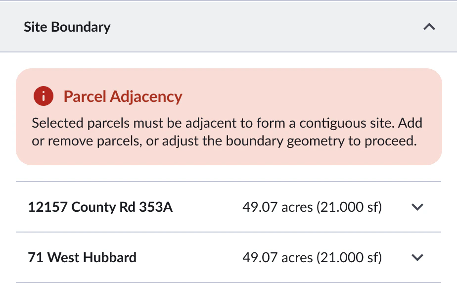
If you select parcels that are not adjacent to each other, a red **Parcel Adjacency** warning appears in the Site Boundary section: "Selected parcels must be adjacent to form a contiguous site. Add or remove parcels, or adjust the boundary geometry to proceed."
 ### Address conflicts
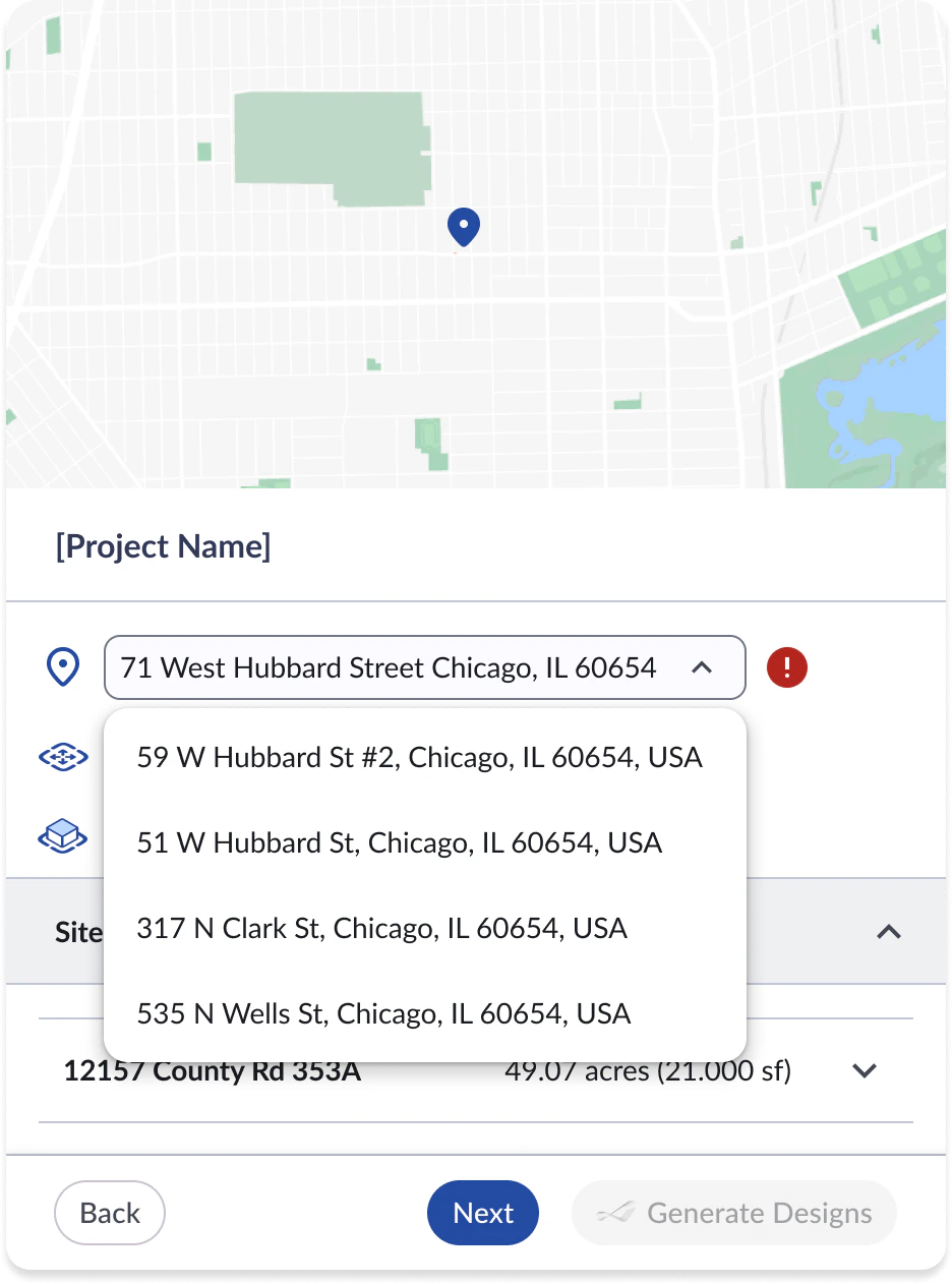
If the site boundary doesn't align with the entered address, a warning icon appears next to the address field. Click the address to see a list of suggested alternatives that better match the selected parcels.
### Address conflicts
If the site boundary doesn't align with the entered address, a warning icon appears next to the address field. Click the address to see a list of suggested alternatives that better match the selected parcels.